
A race to set your own waypoint as far as you can! The NOVA Bordairrace is a 33 h hike & fly competition series. The first one in 2018 took place at Kampenwand near lake Chiemsee in Bavaria.
The weather forecast was very good for the whole competition weekend. It predicted a westerly wind on both days. But on second day a way stronger. So, I decided to head west on day 1!
Besides, the route towards Hochkönig and Dachstein (easterly) is easier to fly. Heading west means, you have to cross the River Inn Valley immediately – and the risk to bomb out is pretty high! I think because of this, only two other competitors tried to cross the River Inn Valley. All others of the almost 60 participants were flying southeast.
As always before the race, you talk to the other athletes and which plans they have. And then you really don’t know what plan is the right one!
So I started the race without a real plan A and just hiked south with the biggest group – the same way as last year.
While I walked the first kilometers, I remembered my plan to go west. And some around me had the same plan. They said there is a nice takeoff further south, and the way up is without that much snow! So I just followed them to the Spitzstein area.
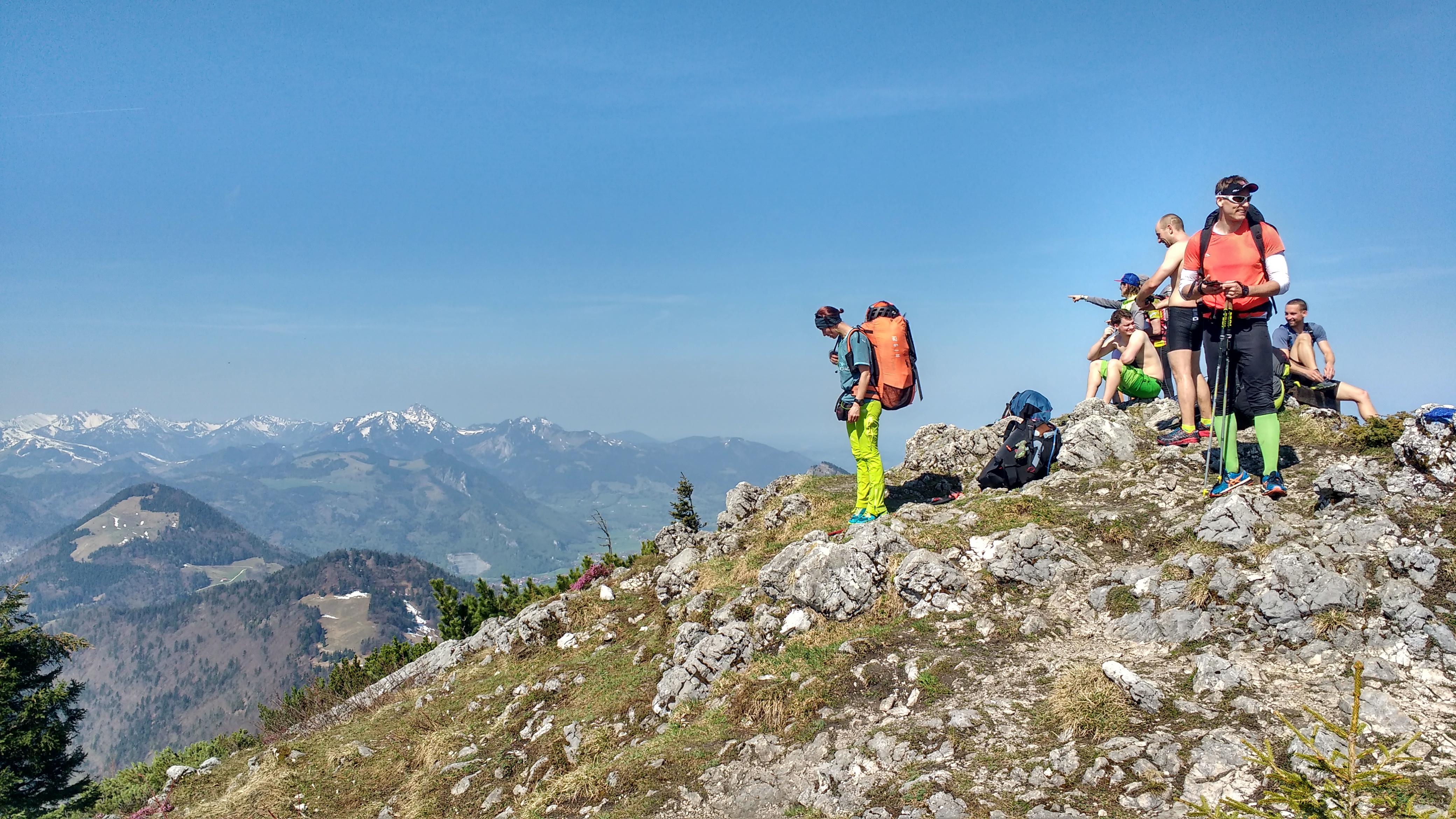
Little snow was correct, but the “nice take-off”. At the summit we had a nice view, but no take-off at all! So we had to descend more than 100 m to find a suitable launch site. I lost around 50 minutes and the risk to find no thermal was also a way higher. The northwesterly wind was feelable and I got stresses to get airborne as fast as possible! The River Inn valley wind can be strong quickly and the crossing would be way harder in that case!
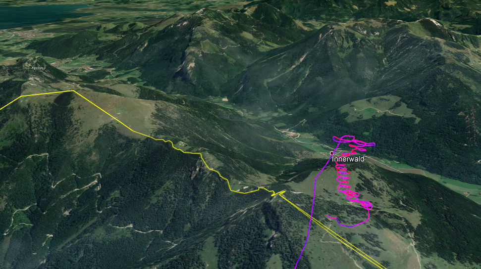
I had a little bit luck and found the right lift just after the takeoff. In the moment when I was higher than the summit the northerly wind made the thermals pretty unstable and turbulent. It wasn’t possible to go as high as necessary for the crossing!
But I tried and the lee side wasn’t that strong so I found the next lift. The River Inn Valley was passed!
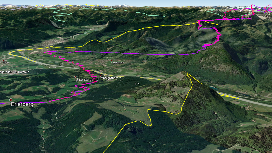
The cloud base now was on 2500+ m and the airspace alarm was ringing quite often. Only two thermals later, I flew into a valley without that much sun but a large cloud over… A BIG mistake to fly into the lee without sun! I was washed down with a ground speeds of 80 km/h. After changing the valley sides twice a rather low altitude, I found a lee side thermal with a very little lift but a bad wind drift…
After rescuing myself from this “black hole”, it was a nice flight. And the afternoon became smoother and smoother. I tried to stay as high as possible and fly high above every lee. The head wind was not that strong (average 10 km/h) and it was a rather easy way to Imst (Tyrol).
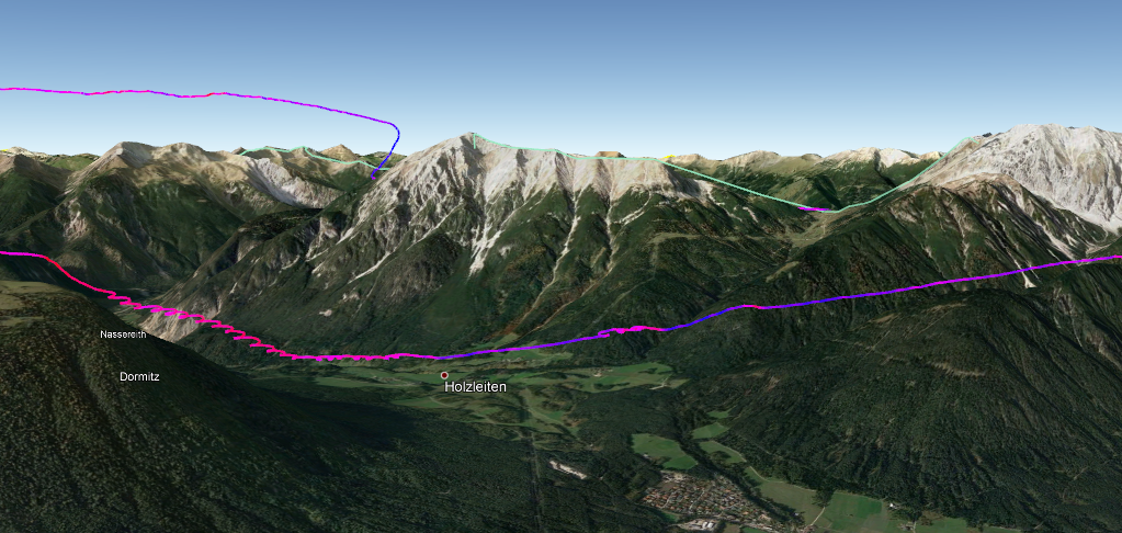
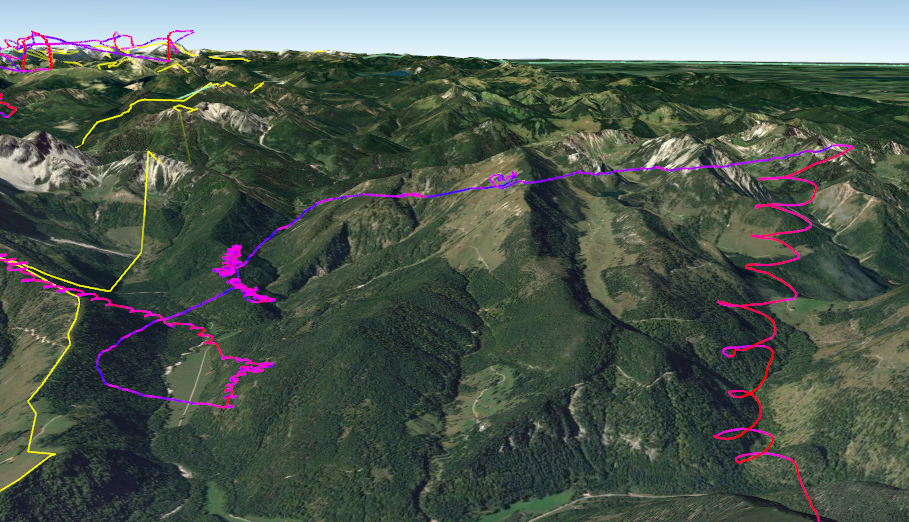
A few kilometers before my turnpoint I came low again. The sun was low already and the valley wind blew over the Mieminger Kette (a mountain chain) into the River Inn Valley, pushing me down again. I fled to the middle of Holzleitensattel and luckily found a zero lift. It pushed me into the shadow side of the Tschirgant ridge. There, the zero lift turned into a good late thermal lift.
At the turnpoint, it was about 5 pm and all other athletes in the east had already turned around. So I flew as far as possible to the southwest of the Tschirgant ridge, while receiving several text messages from live-tracking viewers at home: “Turn around, Ferdi! It is enough! Turn now!”
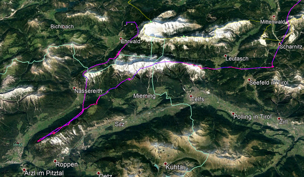
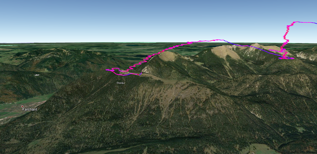
 The way back wasn’t easy. The Inntal ridge already lay in shadow, but it was my only option to jump over into the Zugspitz area.
To jump over notorious Wannig peak isn’t that easy. The airspace make it impossible to fly over the summit and the valley wind blows around the corner and over the Fernpass.
But I managed to fly around and could soar up on Wannig north side in the evening sun. I sent a message my to my supporter that I will soar up Zugspitze and try to fly over Garmisch-Partenkirchen.
A few minutes later I bombed out next to the cable car station. The sun was shining on the rocky mountain face, but the wind just pushed me down helplessly.
Knowing that the way back was only about 100 km as the crow flies, I was looking forward to a nice XC-day with a lot of tailwind. So I just walked to the foot of the next good takeoff. My supporter build our camp on the station of the Wank gondola (yes, I know, it is a pretty odd name for a mountain…).
Day 2 – hewading home to Aschau
On the next day, we did the second – and last – hike up to the take-off. At the top the westerly wind blew strongly. Wank is known as a very good XC take-off. But not to the east. The direction I had to go! So my only option was to get as high as possible and then traverse the long distance to the next thermal.
With that much wind, thermals often don’t have it easy to reach really high. So I tried to gain as much altitude as possible – and flew into a lee again. But there was no other choice…
This time the sun was shining onto the southeast face, I thermaled up high – and the way home started!
My route was a straight line directly back to Aschau!
No useless detours!
20 km/h tail wind!
And then came the final glide back to Aschau. The last thermal over Wendelstein took me pretty high. From there I flew directly to Hochries with one circle only, keeping on soaring to Aschau. I arrived with about 800 meters high left – enough altitude to have fun with my SECTOR before reaching goal!
My flights:
Flight 1 on Saturday
Flight 2 on Sunday
Livetracking review (just until the next event – very nicely made and worth a visit)
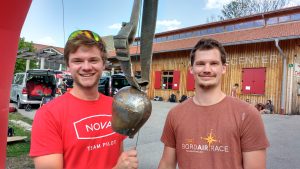
Special thanks to my supporter Max Schmidt!
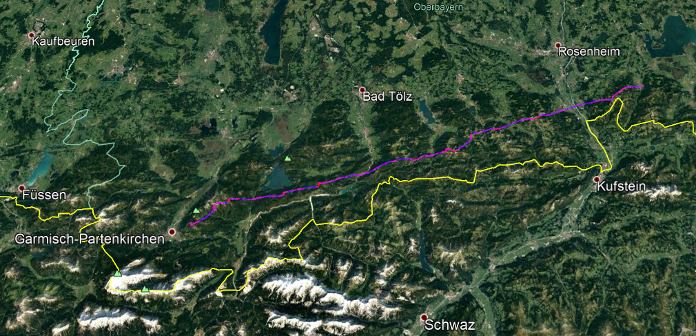
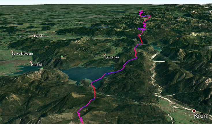
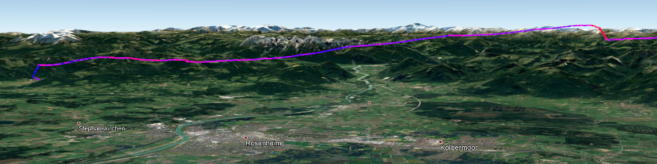
The tracks of the three top-ranked pilots (red = Ferdi Vogel)
2. Place: Philipp Berger – 1. Place: Ferdinand Vogel – 3. Place: Simon Oberrauner